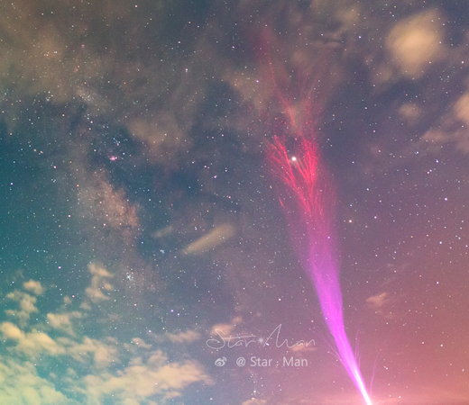
A SPRITE HALO OVER THE CARIBBEAN: Two nights ago, Frankie Lucena of Cabo Rojo, Puerto Rico, trained a video camera over a distant passing storm hoping to photograph upward-directed lightning. It's something he often does. Lucena is a successful sprite hunter. In this case, however, he caught something different--a sprite halo.
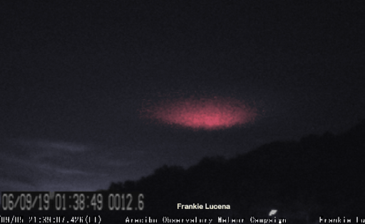
"I was hoping for some sprites, but instead I was treated with this cool looking halo lightning event," says Lucena. "It was generated by a powerful cloud-to-ground lightning discharge just south of the Dominican Republic on the night of Sept 6, 2019."
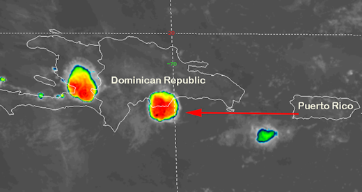
This satellite weather map shows where his camera was pointing:
Sprite halos are giant saucers of light approximately 50 kilometers wide and 10 kilometers thick. They often appear milliseconds before sprites themselves, with sprite streamers hanging down from the saucer's fading afterglow. In this case, however, the halo appeared all by itself.
"There were no sprites," says Lucena. The ionization of the atmosphere may have been too weak to cross the threshold required for streamer formation. That's okay. Sprite halos are cool enough on their own.
http://www.spaceweather.com/archive.php ... &year=2019
September 7, 2019